


Worst Flood In 200 Years Hits India’s Troubled State Manipur
By Madhu Chandra
01 August, 2015
Countercurrents.org
Kakching, Manipur, August 1, 2015: Neither the national media nor state media reported the worst flood that affected in one of India’s most troubled states, Manipur. Entire Thoubal district and parts of Chandel district are submerged. The state’s print media and television news channels, mostly based in the state capital Imphal,ignored the floods, while covering the a month long public strike demanding the Inner Land Permit law. This is said to be the worst flood in 200 years. The state government is in total chaos and unprepared to tackle the situation. Imphal the capital city is not affected by the flood.
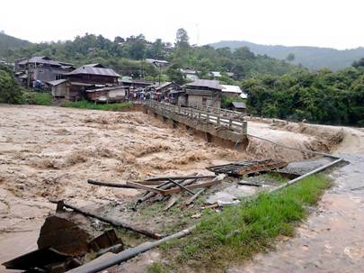
The Asian Highway No 1, the connecting Imphal and Moreh has been cut off. Asian Highway No 1 starting from Wangjing, 26 km from Imphal toward Indo-Myanmar board up to Pallel, has been affected. The old bridge at Pallel is damaged and the lone and newly constructed Pallel Bridge, yet to open has been affected. Newly constructed Heirok bridge of the newly proposed highway to Indo-Myanmar boarder is destroyed. Chakpi River in southern Chandel district washed away the lone Chapikarong bridge. The Chakpi River flooded the entire Serou region in southern part of Thoubal district. The longest and newly constructed Serou Bridge is under threat of destruction.
The lone bridge of Kakching Sekmai River is cracked, public are warned to avoid using the bridge and the newly constructed bridge leading to tourist spot, the Kakching Garden, is blocked as the water has submerged it.
The worse affected areas in Thoubal district according are Wangjing-Tentha constituency, Kakching Sub-Divisional areas, Wabagai-Hiyangalam and Sugnu and Serou area in Thoubal district.
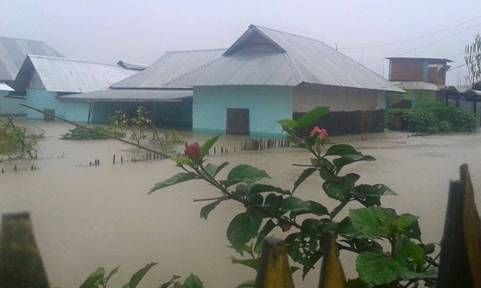
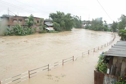
It is the season for agricultural plantation, the worst affected area is known as the rice bowl of Manipur that produce large quantity of agricultural products, not only for the region but for entire state. Over 600 sq km of area are affected with over 500,000 people displaced in two districts. Majority of the population in the flood affected area are farmers, whose paddy crop cultivation is destroyed and will affect crop of the next year. Fisheries farms are submerged and lost. Poultry and piggery in domestic homes are the sole source of livelihood for most of the villagers, which are also destroyed. The market and shops are closed and many are submerged for the last three days.
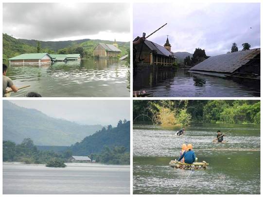
The water level is still rising and people are moved to safer places by volunteers, leaving their houses and their properties unattended. The rain continued to pour for last two weeks and heavy rain is forecast for the coming four days as well.
Total unpreparedness is the situation in regard to the government’s response to the situation. Civil society bodies and clubs came forward to set up limited relief camps for women and children and affected families for survival. Military forces have extended whatever help they could provide.

Comments are moderated